
SaaS & BusinessLive
UniSalon
UniSalon is a salon booking and management platform designed to help salon businesses manage appointments, provider operations, and billing through a connected digital experience.
Access Land Record Information and Useful Land Tools.
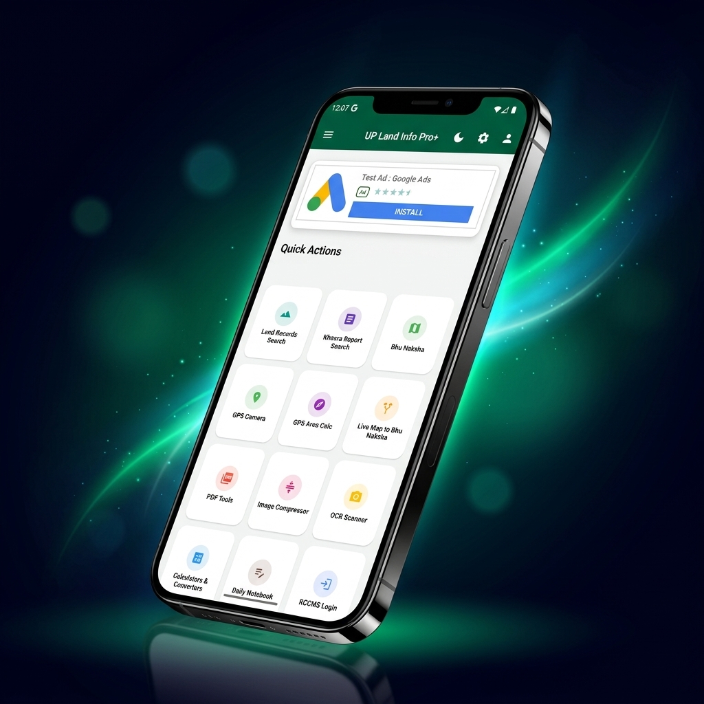
UP Land Info Pro provides citizens in Uttar Pradesh with organized, mobile-friendly access to public land registry information, Bhu Naksha map viewers, and on-site field utilities like GPS camera tagging and document management.
Farmers, property owners, legal professionals, and real-estate developers in Uttar Pradesh.
Mobile Utility Application (Flutter/Android)
UP Land Info Pro is a mobile utility platform designed to bring Uttar Pradesh land-record-related information and practical tools into one application.
Public land records in Uttar Pradesh, while digitized on UP Bhulekh, are often difficult to review on mobile devices due to session timeouts, CAPTCHAs, and complex plot numbering systems. Field workers also lack tools to timestamp and geolocate property photographs on-site.
Structured access around the most frequent citizen needs: Khasra/Khatauni verification, Bhu Naksha inspection, and GPS survey tools.
Designed clear touch-friendly navigation tiles with visual icons, Hindi/English language accessibility, and instant conversion calculators.
Engineered in Flutter with native camera and GPS hardware integrations for watermarked land inspection photographs.
Built to operate reliably under varying cellular network connectivity across rural and urban Uttar Pradesh.
Mobile-adapted guidance for checking official Khatoni and land records across all 75 UP districts.
Structured workflow for verifying plot ownership details, land shares, and co-tenure records.
Integrated viewer facilitating quick inspection of cadastral plot maps and boundary shapes.
On-site camera tool embedding latitude, longitude, address, and timestamps directly on inspection photos.
Calculates perimeter and surface area in Bigha, Biswa, Acre, and Hectares using satellite positioning.
Integrated image compression, PDF scanner, and text extraction for legal paperwork.
Client-centric Flutter architecture leveraging native Android hardware APIs for GPS, camera watermarking, and document processing.
High-contrast dashboard structured for fast one-hand navigation in bright sunlight.
Captures geospatial coordinates and embeds metadata directly into field photos.
Executes client-side conversions between Bigha, Biswa, Square Yards, and Hectares.
Studied Uttar Pradesh revenue record terminology and standard field inspection practices.
Implemented exact regional formulas for Western and Eastern UP Bigha calculations.
Programmed native Android camera overlays embedding live GPS coordinates.
Built responsive viewport containers for state cadastral map sheets.
Tested accuracy across diverse mobile chipsets under varying GPS signal strengths.
Shipped to Google Play Store with active version monitoring.
UniSalon is a salon booking and management platform designed to help salon businesses manage appointments, provider operations, and billing through a connected digital experience.
AstroTalky is an AI-powered astrology application built to provide an interactive astrology experience through a mobile-first product.
BanglaSathi is a digital information platform focused on government schemes, public-benefit information, and career-related updates for users in West Bengal.
Let's turn your next software idea into a well-engineered digital product. We blueprint architectures, estimate timelines, and ship production-ready applications.